Applications
A collection of some of the web-based applications that we have made.
Free to explore.
Air Quality Monitoring Dashboard
A dashboard that demonstrates the versatility and convenience of customized data dashboards for environmental monitoring. This program centers on the lower mainland of British Columbia. [Explore]

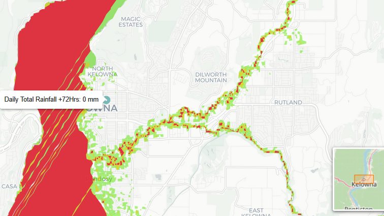
Stream flow and Computational Inundation Mapping
An interactive map on the Okanagan valley. A demo on computational flood mapping, this map is constructed from LiDAR data provided by the government of British Columbia. [Explore]
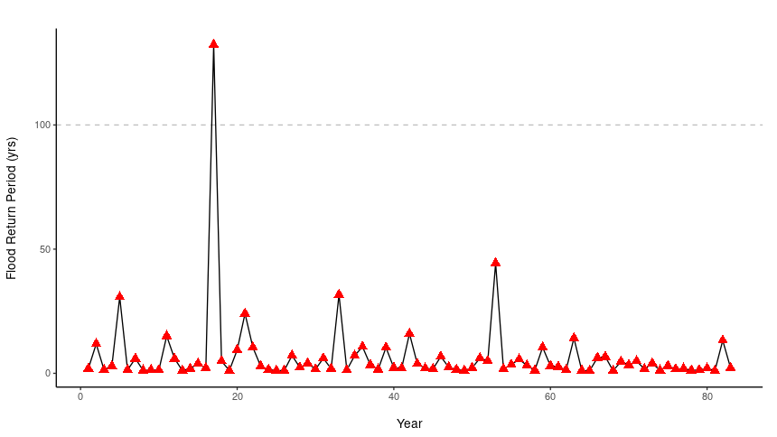
Gaussian Flow Simulator
A Gaussian flow simulator made as an educational tool to demonstrate how flood risk is a probability and its unpredictability. It uses a theoretical Gaussian flow to simulate peak flows. [Explore]